In addition to our conference program, we offer side events on cartographic topics with cooperating institutions:
- Guided visit to the facsimile edition of the Tabula Peutingeriana
- Exhibition „The Longest Voyage”
- MapRun – Orienteering with your smartphone
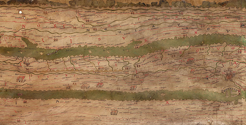
Guided visit to the facsimile edition of the Tabula Peutingeriana
As the only preserved map of the public road system of the late Roman Empire, the Tabula Peutingeriana provides insights into the management and economy of a great ancient empire. In the guided visit, you will have the chance to see the facsimile edition of the Tabula Peutingeriana, presented in the Augustinian Reading Room at the Austrian National Library and be introduced to its history and details on the map. You can also view it online via the digital library of the Austrian National Library.

- Date and time: September 19th or 20th, 16:00 -17:00 CET
- Location: Josefsplatz 1, 1010 Vienna
- Fee: €15.00
- Registrations are binding, and payments are non-refundable.
- Registration deadline: 11th of September
- Minimum number of participants for a group: 10
- Maximum number of participants for a group: 25
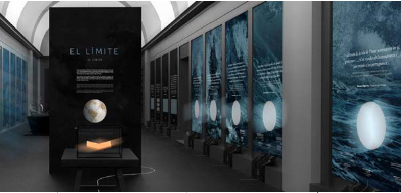
Exhibition „The Longest Voyage”
500 years ago, a long-dreamed-of human journey began in Seville: to reach the mythical Orient from the unexplored side of the world. This voyage started by Ferdinand Magellan in 1519 would turn into the greatest maritime adventure in history: the first round-the-world voyage completed by Juan Sebastián Elcano and the men of the ship Victoria in 1522. A key journey in the history of exploration, a journey that forever changed the world.

By bringing the exhibition project The Longest Voyage to EuroCarto 2022 and the Technische Universität Wien, the Spanish Embassy in Austria wants to commemorate the 5th centenary of the first round-the-world voyage. The exhibition has the objective of disseminating the importance of this journey in universal history and paying tribute to man’s exploratory spirit and his attitude to the unknown.
Ferdinand Magellan and Juan Sebastián Elcano’s great challenge was to circumnavigate the world crossing an unknown sea sometimes by looking at the stars, taking advantage of the sea currents and using elementary geometric methods. The circumnavigation of the world would allow a broader scientific knowledge of the Earth, it ratified that the Earth was round and led to the first representation of the Pacific Ocean in maps.
Some cartographic works that reflect the results of the first circumnavigation of the Earth are the planispheres of Castiglioni and Salvati; the oval map 10, attributed to Battista Agnese (1514-1564), and the World Map (1523), by Americo Vespucci, where the Strait of Magellan is already mapped, although the name is not specified.
The Longest Voyage reflects on mankind’s attitude towards travel and the unknown by connecting the first round-the-world voyage in history with the individual challenges of the present and the collective challenges of the future. The dream of doing, the value of departing, the experience of voyaging and the fullness of returning are emotional aspects common to all exploratory journeys, and the discourse of the exhibition is built upon them. The show is designed as a great conceptual map which visitors will traverse guided by the testimony of its protagonists. Moreover, some panels contain QR codes for the visitor to enjoy additional multimedia information to complement the graphic content.
Presented by:

Twitter / Facebook
In cooperation with:
- Acción Cultural Española AC/E
- Spanish Agency for International Development Cooperation (AECID)
- Ministry of Culture and Sport. Government of Spain
- Subdirectorate-General for State Archives
- Date and time: September 19th to 21st, 08:00-20:00 CET
- Location: At the conference venue. Main entrance, ground floor.
- Fee: free of charge
MapRun6 – Orienteering with your smartphone
Attending the conference does not require physical activity. Yet, people need to move to stay healthy. More exciting is to take yourself orienteering – whenever you have free time in the beautiful city of Vienna.
You can use the mobile application MapRun6® (free download from Google Play or App Store) and participate in the orienteering event. There are different events and maps around the city. The closest is directly in the Resselpark – in front of the conference venue.
Just press the button “Events Near Me” to get the information for your position and start your MapRun.
